


Auction 83 - Part I - Rare and Important Items
Thomas Fuller – A Pisgah-Sight of Palestine – London, 1650 – Maps of Palestine and Additional Engravings
Opening: $1,200
Estimate: $2,000 - $3,000
Sold for: $1,500
Including buyer's premium
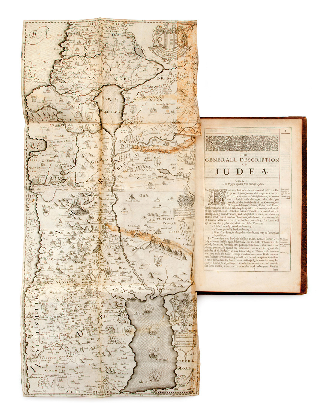
A Pisgah-sight of Palestine and the Confines thereof, with the History of the Old and New Testament acted thereon, by Thomas Fuller. Printed by J.F for John Williams, London, 1650. English with some Latin.
Comprehensive study on the subject of Palestine and its history in accordance with the Bible and New Testament, by Thomas Fuller (1608-1661), English churchman, historian and author.
The book features 30 engraved plates (most of them double) including an engraved title page and a frontispiece illustrating the heraldic emblems of aristocratic families; large map, folded, of the Holy Land; a map of Jerusalem and maps charting the territorial boundaries of the Twelve Tribes of Israel; plates with plans and illustrations portraying the Temple in Jerusalem; and more.
Fuller based his work on maps by Christian van Adrichem, adding numerous illustrations and decorations of his own. The maps are adorned with the heraldic emblems of aristocratic families, and bear dedications to patrons and philanthropists who assisted Fuller in publishing the book.
[8], 434 (more than 434; mispagination), [1], 202, [17] pp. 30 engraved plates. (most engraved plates. included in pagination), 33.5 cm. Good condition. Stains. Minor blemishes. Stains and tears to map of Holy Land. Tears, incl. open tears, to several additional engravings (mended with paper). New binding, with parts of original binding laid down; blemished (with tears and abrasions).
Palestine – Maps and Travelogues
Palestine – Maps and Travelogues