Auction 71 - The Collection of Rabbi Prof. Daniel Sperber
Map of Palestine – Abraham Ortelius – Antwerp, 1570 – Hand-Colored Engraving
Opening: $300
Unsold
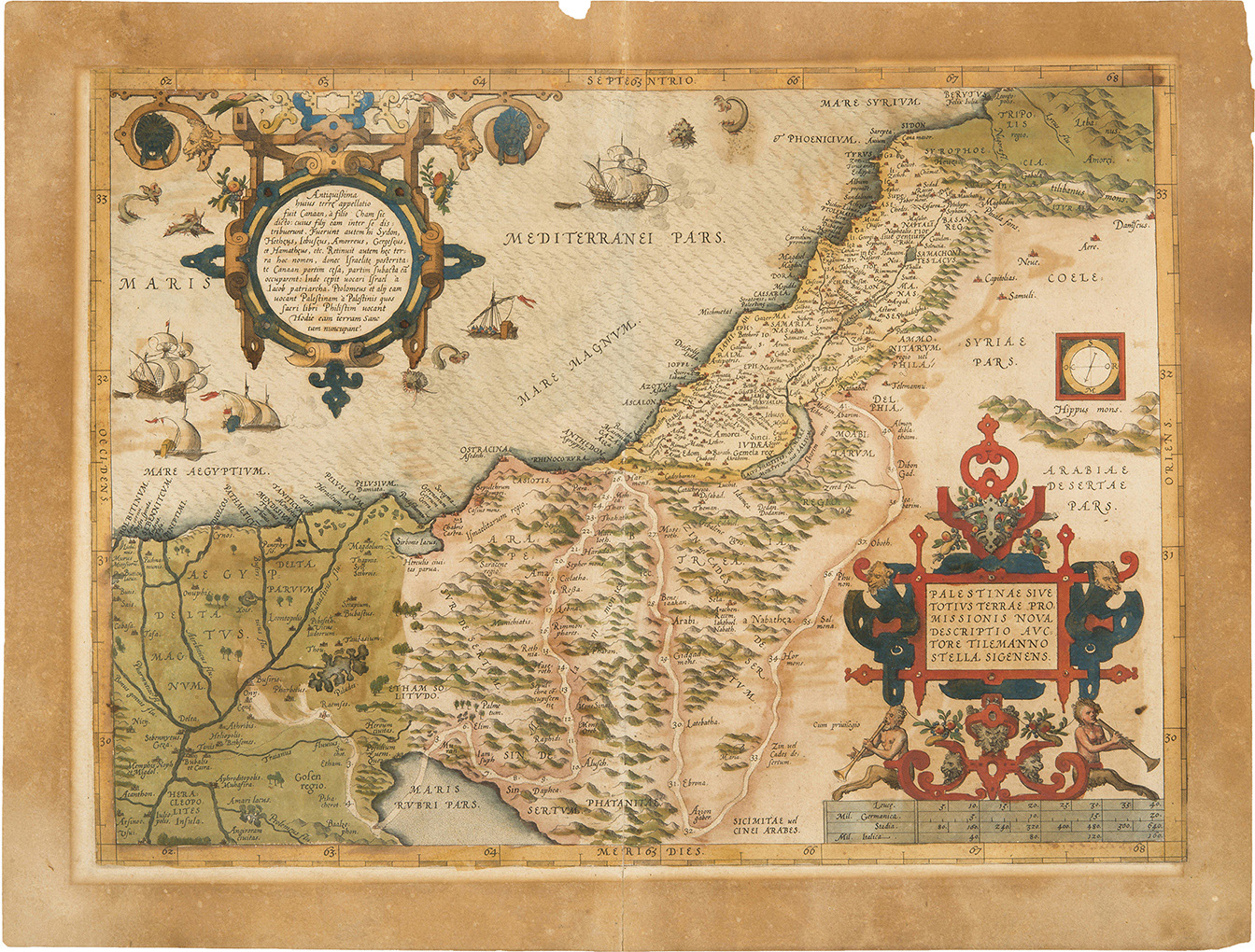
Palestinae sive totius Terrae Promissionis nova descriptio auctore Tilemanno Stella Sigenens, map of Palestine. Hand-colored engraving, from the first edition of the Theatrum Orbis Terrarum by Abraham Ortelius. [Antwerp, 1570]. Latin.
A map of Palestine showing both sides of the Jordan River (after Tilemann Stella), delineating the territories of the Twelve Tribes and the route of the Israelites from Egypt to Canaan. The shoreline runs from Beirut to the Nile Delta. The Dead Sea is crescent-shaped.
A cartouche at the top left corner reads: "Antiquissima huius terre appellatio fuit Canaan… Hodie eam terram Sanctam nuncupant" (Latin); surmounted by an additional small, blank cartouche (in later maps, a year or another inscription was printed in this space). Latin text on verso: "Palaestina vel Terra Sancta".
First edition. Two other editions were issued in 1579 and 1595.
Engraved map: 47X35 cm (printed on two conjoined sheets). Good condition. Browning to margins and verso. Open tears to margins of sheet (not affecting the map). A small tear to central vertical fold (between the two sheets).
Laor 539.
See following item.
Maps of Palestine
Maps of Palestine