


Online Auction 31 - Jewish and Israeli History and Culture
Part I
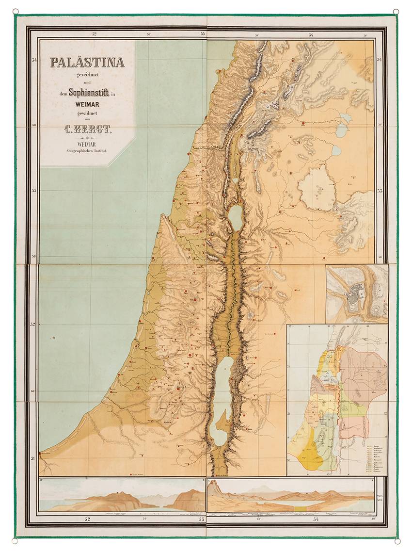
A Large Wall Map of Palestine – Published by the Geographic Institute of Weimar – Early 20th Century
Opening: $200
Sold for: $250
Including buyer's premium
Wand Karte von Palaestina – gezeichnet und dem Sophienstift in Weimar gewidmet von C. Hergt [Wall Map of Paelestine, Drawn and Dedicated to Sophienstift in Weimar by C. Hergt]. Weimar: Weimar Geographisches Institut, [1902?]. German.
Large color wall map of Palestine. With smaller inset maps of Jerusalem and the estates of the Twelve Tribes, and a topographic profile of various sites in Palestine, showing their height above sea level. The map is cloth-backed, folded and placed in an original cardboard portfolio.
Possibly, the map was made for the Sophienstift School for girls in Weimar (a school for girls named after Princess Sophie of the Netherlands).
101.5X137 cm (eight sections), cloth-backed and folded. Suspension loops attached to all four corners. In an original portfolio (52.5X37 cm). Good condition. Stains. Minor blemishes. The portfolio has four laces for tying, one of which is torn.
Not in OCLC nor in the Eran Laor Cartographic Collection.
Palestine Travelogues, Maps and Prints, Research Expeditions to the Middle East, Palestine Guidebooks
Palestine Travelogues, Maps and Prints, Research Expeditions to the Middle East, Palestine Guidebooks